


Nepal and Tibet face mounting death toll as glacier collapse triggers catastrophic transboundary floods
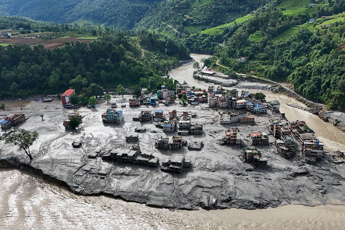
Photo Collected
A catastrophic flood and landslide event along the Nepal-China border on August 26 has claimed over 300 lives, with more than 1,500 people still reported missing. Preliminary analysis by the United States Geological Survey (USGS) and international experts suggests the disaster was triggered by the collapse of a massive portion of a glacier at an altitude of 5,000 meters. The resulting surge of ice, rock, and debris devastated valleys on both the Nepalese and Tibetan sides of the border.
Experts from the International Centre for Integrated Mountain Development (ICIMOD) have clarified that the disaster originated from a glacial front collapse rather than a Glacial Lake Outburst Flood (GLOF), though the mechanisms of the destruction are similar. ICIMOD glaciologist Sunbi Maskey and hydrologist Niha Shrestha Pradhan emphasize that the intensifying scale and frequency of such events in the Hindu Kush-Himalayan region serve as a critical warning of shifting environmental stability.
Long-term studies underscore the accelerating transformation of the Himalayas. Research published in *Science Advances* in 2019 revealed that the rate of ice loss in Himalayan glaciers doubled between the periods of 1975–2000 and 2000–2016, largely driven by atmospheric warming and the accumulation of black carbon. This loss has rendered high-altitude landscapes, once considered geologically stable, increasingly volatile.
Hydrologist Niha Shrestha Pradhan noted that when a glacier collapses, the resulting mixture of water, ice, and debris creates a dense, high-velocity, and heavy mudflow that is far more destructive than standard floodwaters. As these torrents descend through narrow mountain valleys, they trigger a “cascading erosion” process—stripping away sediment, soil, and rocks along the riverbanks, which exponentially increases the debris volume and kinetic energy of the flow as it moves downstream.
The disaster highlights the extreme vulnerability of transboundary river basins. Research cited by ICIMOD indicates that at least 47 glacial lakes in the region are categorized as potentially hazardous, with 25 in China, 21 in Nepal, and one in India. These lakes, situated along the Koshi, Gandaki, and Karnali river basins, pose a persistent threat to settlements, hydroelectric infrastructure, and major transportation routes like the Arniko Highway.
While individual events of this magnitude remain difficult to predict with pinpoint accuracy, the systemic risk has been well-documented. Experts stress that the current disaster is not an isolated incident but part of an escalating trend in mountain ecosystem volatility.
To mitigate future loss, ICIMOD researchers are calling for improved cross-border cooperation regarding data sharing. While comprehensive hydrological data exchange remains diplomatically complex, experts argue that providing early alerts regarding water level surges in upstream areas is essential. Establishing such communication protocols between Nepal, China, Bhutan, and India could provide downstream populations with the critical time needed to prepare, potentially saving lives and reducing widespread infrastructure destruction.
0%
0%
0%
0%
More News from Science